Vermont: maples, covered bridges and autumn colours
Updated on
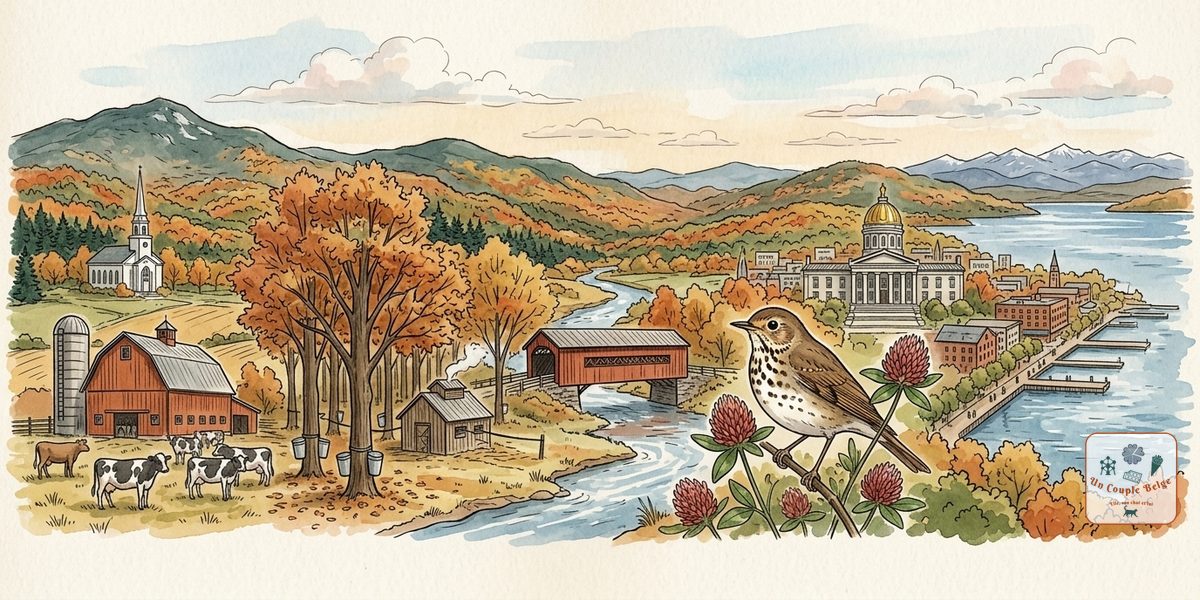
Vermont is the picture many people have of New England: red barns, white churches with pointed steeples, wooden covered bridges, hills covered in maples and sugarhouses steaming at the end of winter. It’s one of the least populated states in the country, without a single town of more than 50,000 inhabitants, and it’s rather proud of that.
It also has an independent spirit. From 1777 to 1791, Vermont was a self-governing republic, with its own currency and a constitution that banned adult slavery, a first. In 1968 it was the first state to ban billboards along its roads: you drive without seeing a single advertisement, which changes everything. And in autumn, when the Green Mountains turn red and orange, it becomes one of the most sought-after destinations in the country.
Vermont at a glance
- Capital: Montpelier, the least populous of the state capitals (about 8,000 inhabitants)
- Largest city: Burlington, about 45,000 inhabitants
- Population: about 650,000, the second least populous state after Wyoming
- Area: about 24,900 km², a little over three-quarters of Belgium
- Joined the Union: 1791, 14th state, the first after the thirteen founding colonies
- Time zone: Eastern Time (6 hours behind Brussels)
- Nickname: Green Mountain State. The name Vermont is in fact said to come from the French “verts monts”, green mountains.
- Highest point: Mount Mansfield, 1,339 metres
Geography: the Green Mountains and Lake Champlain
The Green Mountains run the whole length of the state from north to south, like a wooded backbone. Here you’ll find the ski resorts (Stowe, Killington, Sugarbush) and the Long Trail.
The Lake Champlain valley, to the west, is flatter and agricultural, with dairy farms, orchards and Burlington, on the shore of the lake that marks the border with New York State.
The Connecticut River valley, to the east, separates Vermont from New Hampshire.
The Northeast Kingdom, in the north-east, near Canada, is the wildest region: forests, lakes and isolated villages.
Forest covers about three-quarters of the state, and Quebec is just to the north: Montreal is only 1 hr 30 from Burlington.
A bit of history
The Abenaki lived here. In 1609, the French explorer Samuel de Champlain reached the lake that bears his name. The region was fought over by France and England, then by the colonies of New York and New Hampshire. Ethan Allen’s Green Mountain Boys, a settler militia, distinguished themselves during the War of Independence, notably by capturing Fort Ticonderoga in 1775.
In 1777, Vermont declared itself an independent republic. It joined the United States in 1791. In the 19th century it was a land of sheep farming, then dairy cows, and of marble and granite quarries. Many inhabitants left for the West. Vermont has given the country two presidents, Chester Arthur and Calvin Coolidge. In the 20th century, tourism, skiing and a certain back-to-the-land movement transformed the state. In 2000, it was the first to recognise civil unions between same-sex couples.
The must-sees
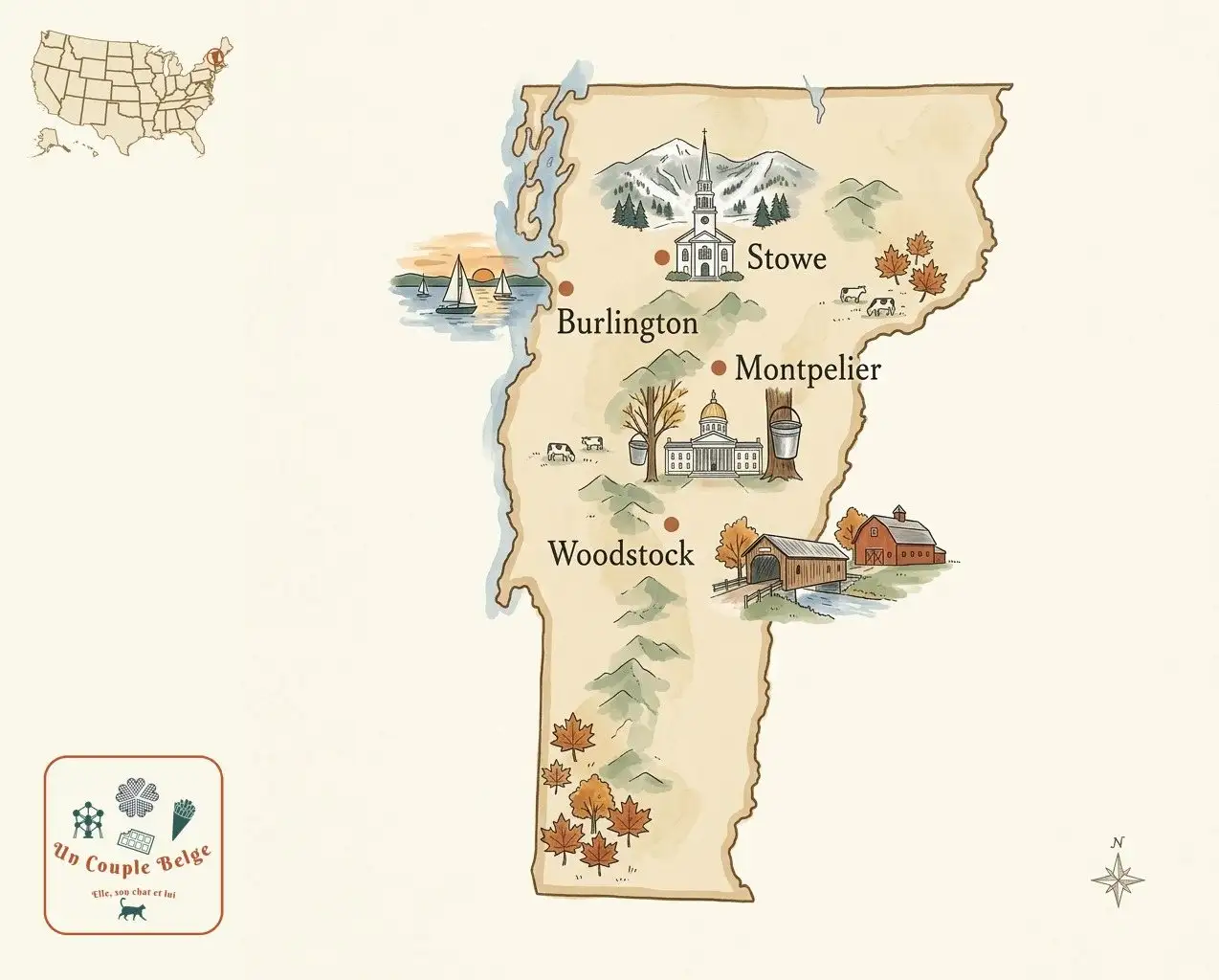
Stowe and Smugglers’ Notch
Stowe, at the foot of Mount Mansfield, is mountain Vermont par excellence: a village with a white church, inns and one of the most renowned ski resorts in the East. In summer and autumn, a toll road and a gondola go up towards the summit of Mansfield, and the Stowe Recreation Path, a trail of about 9 kilometres along the river, can be walked or cycled. Up on the hill, the Trapp Family Lodge was founded by the von Trapp family, of The Sound of Music 🎬, after they left Austria.
North of Stowe, Route 108 crosses the pass of Smugglers’ Notch, a narrow gap between enormous boulders, by way of very tight bends. It’s closed in winter.
Waterbury and Ben & Jerry’s
The ice cream brand Ben & Jerry’s was founded in 1978 by two childhood friends in a former petrol station in Burlington. The Waterbury factory can be toured, with a tasting at the end. The funniest part is the Flavor Graveyard, a little cemetery where each discontinued flavour has its headstone and epitaph. On the same road, Cabot (cheeses) and the Cold Hollow Cider Mill (cider and cider donuts) are good food stops.
Burlington and Lake Champlain
Burlington, the state’s largest city, owes its energy to its university and to Church Street, a pedestrian street lively with cafés and buskers. The lakefront has a long cycle path, the Island Line Trail, which runs out along an old railway causeway in the middle of the lake. The sunsets over Lake Champlain, with the Adirondacks in the background, are superb. It’s also the city where Bernie Sanders, senator for Vermont, was mayor in the 1980s.
Just to the south, the Shelburne Museum brings together a vast collection of American folk art spread across dozens of historic buildings, including a steamboat, and Shelburne Farms is a model farm on the lakeshore.
Woodstock and Plymouth Notch
Woodstock, with its covered bridge, its village green and its colonial houses, is often cited as the most beautiful village in Vermont. Marsh-Billings-Rockefeller National Historical Park, devoted to conservation, and Billings Farm, a working dairy farm, can be visited. Close by, Quechee Gorge is a gorge some fifty metres deep, nicknamed “Vermont’s Little Grand Canyon”.
A few kilometres away, the hamlet of Plymouth Notch has kept the setting where Calvin Coolidge was born, in 1872, the only president born on the Fourth of July. It was here, in the family home, that he took the oath of office in 1923, by the light of a kerosene lamp, before his father, a notary public, on the death of President Harding.
The covered bridges
Vermont still has around a hundred wooden covered bridges, one of the highest concentrations in the country. Their roofs protected the structure from snow and rain. Some, such as the Pulp Mill Bridge, near Middlebury, date from the early 19th century and are still open to traffic. The longest, the Cornish-Windsor Bridge, spans the Connecticut River to New Hampshire.
Route 100
Route 100, a two-lane road, crosses Vermont from north to south for more than 300 kilometres, following the valleys of the Green Mountains. No motorway, no shopping centres, no billboards: just villages, farms, general stores and ski resorts. It’s the most beautiful road in the state in autumn.
Southern Vermont
Manchester mixes outlet shops with elegant villages. You can visit Hildene, the summer home of Robert Todd Lincoln, the president’s son, and drive up to the summit of Mount Equinox on a toll road. The village of Weston has the famous Vermont Country Store, an old-fashioned general store, and Grafton is an entirely restored village. Bennington has a tall obelisk commemorating a battle of 1777, and the grave of the poet Robert Frost. Brattleboro, a former industrial town, has an artistic, alternative feel.
And more…
- The Long Trail, created in 1910, the oldest long-distance hiking trail in the United States, which follows the Green Mountains for about 440 kilometres, from Massachusetts to Canada.
- Barre, the granite capital, where you can visit the giant Rock of Ages quarry.
- Montpelier, the little capital, and its State House with a golden dome.
- The Northeast Kingdom, for wild lakes such as Willoughby, and the mountain-bike trails of Kingdom Trails.
Itinerary ideas
5-7 days, the Vermont loop. Brattleboro → Manchester and Bennington (1 day) → Weston and Grafton → Woodstock and Plymouth Notch (1-2 days) → Route 100 → Stowe and Waterbury (2 days) → Burlington and Lake Champlain (1-2 days).
10-14 days, New England in autumn. Boston → western Massachusetts (the Berkshires) → southern Vermont → Route 100 → Stowe → White Mountains (New Hampshire) → Maine.
In combination. Vermont combines with Montreal (1 hr 30 from Burlington) or the Adirondacks (New York), via the ferry across Lake Champlain.
On the plate
- Maple syrup, the pride of the state, which produces about half of America’s syrup. Visit a sugarhouse and taste the different grades, from golden to very dark. In spring, try sugar on snow, hot syrup poured over snow.
- Cheddar, such as Cabot’s or Grafton Village’s, and the many farmhouse cheeses.
- The creemee, the local name for soft-serve ice cream, ideally maple-flavoured.
- Cider donuts, a must in autumn.
- Craft beers: Vermont has one of the highest densities of breweries per inhabitant in the country, including the highly regarded The Alchemist and Hill Farmstead.
- Apple pie served with a slice of cheddar, a local tradition.
Culture and trivia
- Montpelier is the only state capital without a McDonald’s.
- No billboards: Vermont is one of four states to have banned them, along with Hawaii, Alaska and Maine.
- There are more cows than people in some counties, and the black-and-white Holstein cow is a symbol of the state.
- The band Phish was born in Burlington, in the 1980s.
- The writer Rudyard Kipling lived for a few years near Brattleboro, where he wrote The Jungle Book.
When to go
- Autumn (late September to mid-October): foliage season, magnificent but very busy and expensive. The peak comes first in the north and at altitude.
- Winter (December to March): ski season, with Stowe and Killington. Cold, often snowy.
- Late winter (March-April): sugaring season, when maple syrup is made. On Maple Open House Weekend, in late March, the sugarhouses open their doors.
- Spring (late April-May): “mud season”, when the dirt roads are impassable. The least interesting time.
- Summer (June to August): green and pleasant, ideal for hiking, the lake and festivals.
Practical information
- Recommended length of stay: 5 to 7 days for a full road trip, or 2-3 days on a tour of New England.
- Getting there: Burlington airport is served by connecting flights. Boston (a 3-hour drive) and Montreal (1 hr 30) are often more convenient. Amtrak serves a few Vermont towns.
- Getting around: a car is essential.
- Budget: high during foliage season and in winter in the resorts, more affordable the rest of the year.
- Things to watch out for: beware of deer and moose on the roads at night. Many back roads are unpaved, especially in the Northeast Kingdom.
- One more tip: for autumn, book accommodation several months ahead and follow the foliage forecast maps published by the tourist board.